
About Garner State Park Images
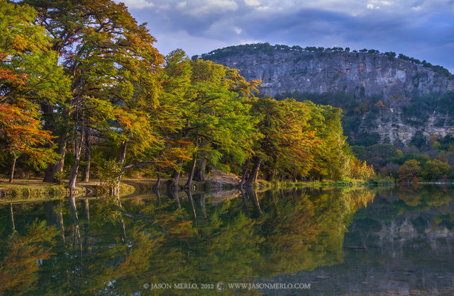
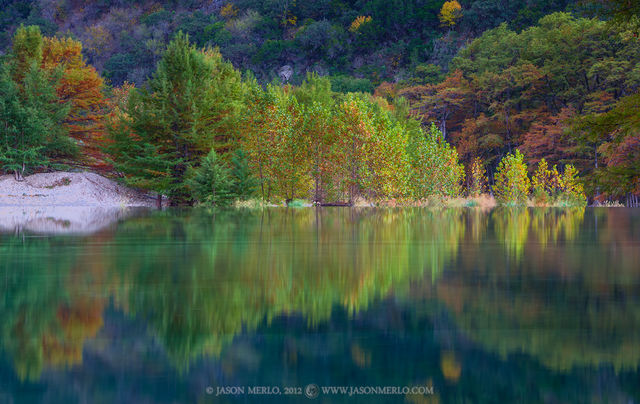
This gallery contains images from Garner State Park, located between Concan and Leakey on the Frio River in Uvalde County in the Balcones Canyonlands region of the Texas Hill Country. Deep canyons, clear streams, high mesas, and carved limestone cliffs characterize this dramatic terrain. Edwards limestone uplifted millions of years ago, creating the steep canyon walls that make up the park. The rock formations in the park were created in the Cretaceous age, which lasted from 138 million to 63 million years ago. Because the park’s canyons angle southeast to northwest, prevailing winds cool and moisten the area and allow lusher vegetation than normal for this region. Especially noteworthy trees are Texas madrone and lacey oak. The steep slopes and canyons shelter some very old Ashe junipers, and towering bald cypresses line the Frio River.
The land that is now Garner State Park has been inhabited for at least 10,000 years. In the 1850s, Anglo settlers began trickling west of San Antonio. Two German immigrant families, the Magers and the Streibs, settled on land that would become Garner State Park. Local citizens later acquired this land and enlisted the Civilian Conservation Corps to build the park. After construction was completed, the park was donated to the state. The park opened June 1, 1941, and was named for John Nance “Cactus Jack” Garner. Garner was a Uvalde native who served as vice president of the United States from 1933 to 1941.
Prints and Licensing
For more information regarding licensing images or purchasing photos as prints click here. If you have a specific inquiry please feel free to contact me using the website's contact form here.